Current Weather for Southern California Communities
Sat Mar 14 22:38:34 PDT 2026
WeatherCurrents
Weather News
Consulting
Mobile Access
On Your Site
Press Releases
Station Hosting
For Developers
Contact Us
 RSS Feed
 Follow Us
Weather Sites
Local Roundup
Anza
Fallbrook
French Valley
Hemet
Lake Elsinore
Moreno Valley
Murrieta
Pinon Hills
Riverside (Canyon Crest)
Riverside (Presidential Park)
San Jacinto
Simi Valley
Temecula
Follow Us
Weather Sites
Local Roundup
Anza
Fallbrook
French Valley
Hemet
Lake Elsinore
Moreno Valley
Murrieta
Pinon Hills
Riverside (Canyon Crest)
Riverside (Presidential Park)
San Jacinto
Simi Valley
Temecula
RSS Feed
Follow Us
Weather Sites
Local Roundup
Anza
Fallbrook
French Valley
Hemet
Lake Elsinore
Moreno Valley
Murrieta
Pinon Hills
Riverside (Canyon Crest)
Riverside (Presidential Park)
San Jacinto
Simi Valley
Temecula
Rain gauges: Murrieta and Moreno Valley back; totals corrected
Posted December 20, 2010, 5:04 PM.
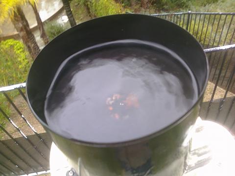
At this point all thirteen rain gauges in the WeatherCurrents network should be reporting normally. The Murrieta rain gauge was unclogged this afternoon. A couple of pictures of the clog and the setup are below. Water was poured slowly back in through the gauge, so yesterday's totals are too low and today's are too high, but the storm totals should be on target. The Moreno Valley gauge was unclogged this morning. Water was also poured back through there, and corrected this afternoon using another source about a mile away. The corrected totals for yesterday and today are believed to be accurate for that location. 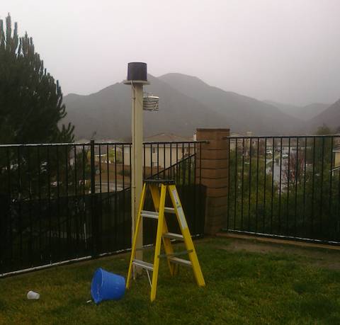
|
Other Recent Weather News for WeatherCurrents
|