Currently
N/A°F
in Temecula, California, USA

N/A°F / N/A°F
N/A
N/A
Sunday, December 14, 2025 5:04 PM PST
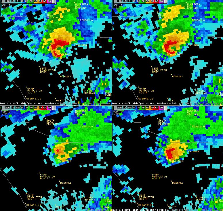
 Tornados Tear Through Fallbrook, Rainbow and Temecula: February 19, 2005
| This series of images shows the progress of the tornado through the Fallbrook area at 9:20am on February 19th, as captured by doppler radar near Poway in San Diego County, which measures reflectivity. These images represent four different elevations from the horizon (from the top left, 0.5 degrees, 1.5 degrees, 2.5 degrees and 3.5 degrees going clockwise). The red curl in the top left photo is a hook echo commonly associated with storms that may have tornado potential. Montage courtesy of the National Weather Service, San Diego office. |
 |