Currently
N/A°F
in Jurupa Valley, California, USA

N/A°F / N/A°F
N/A
N/A
Thursday, June 11, 2026 9:55 AM PDT
Jurupa Valley
Currently
Forecast
Past Weather
Climate
Last 36 Hours
Weather News
Features
F.A.Q.
Contact Us
Use °C/Metric
 RSS Feed
 Follow UsWeatherCurrents
Local Roundup
Mobile Access
On Your Site
Follow UsWeatherCurrents
Local Roundup
Mobile Access
On Your Site
Two small fires in San Gorgonio pass area contained Saturday
By John C. Toman. Posted October 23, 2011, 11:21 AM.Very warm weather contributed to a couple of small vegetation fires Saturday south and east of the Banning area. One fire was reported at 2:31pm and was located about ten miles east of Banning near Whitewater Canyon Road, two miles north of Interstate 10, according to the Riverside County Fire Department. Firefighters contained that fire at 20 acres. The second fire was reported near State Route 243 and Mount Edna Road, up the hill about two miles south of Banning, at 3:05pm. About 25 acres of brush and grass burned before containment at around 7pm. Only light breezes were reported in the vicinity of the fires, which made their quick containment easier. No structure were threatened. 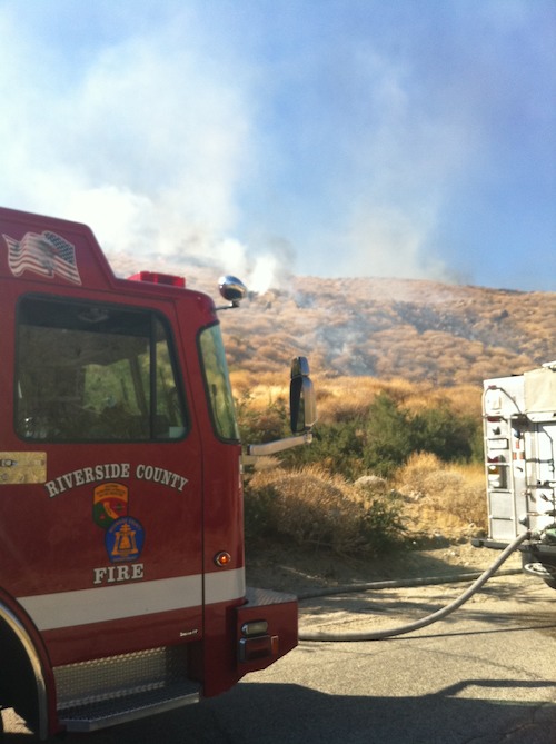
Smoke from a 25-acre wildfire, as seen between fire engines (courtesy Riverside County Fire) |
Other Recent Weather News for Jurupa Valley, California
|