N/A°F / N/A°F
N/A
N/A
Outlook: June near normal
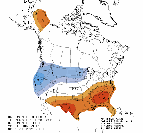
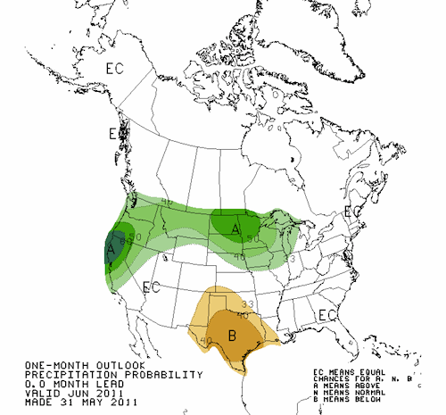
Posted June 5, 2011, 3:59 PM.Although the first week of June has mirrored the cooler-than-normal trend we've seen for a while in Southern California's inland valleys, the outlook for the rest of the month, according to NOAA's Climate Prediction Center, is for normal rainfall and temperatures. The outlook predicts an equal chance of greater than normal or less than normal precipitation and temperatures for the month. We're entering what is typically the driest period of the year. June and July generally record the least precipitation, with a little more in August. Summer rainfall is usually due to monsoonal moisture, or from tropical storm remnants, and rarely comes from the west as it does at other times in the year. June in Southern California is famous for morning marine layer, especially near the coast. The inland areas are much less likely to be socked in, and although morning low clouds are a common occurrence, they don't linger nearly as much. Exceptions to this are Fallbrook and De Luz, which are more influenced by the coastal climate than the rest of the inland areas. The June outlook does show a greater than normal chance of rainfall and a probability of lower than normal temperatures for the north, beginning in Ventura County and continuing north. The jet stream has pursued a southerly path for much of the spring, and mild systems are still affecting Central and Northern California. Here's what's normal for the month of June, by community:
Note: normals are used for communities with five or more years of data. 
Temperature outlook for June 
Precipitation outlook for June |
Other Recent Weather News for San Bernardino, California
|