N/A°F / N/A°F
N/A
N/A
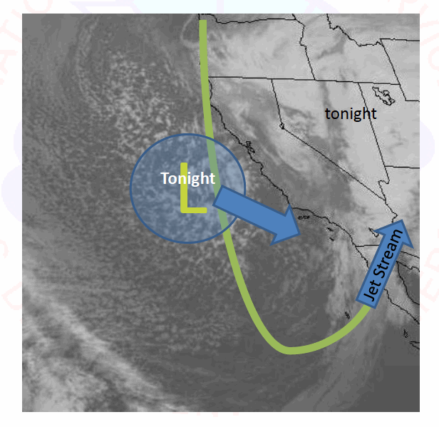
Each storm system has its own "personality"
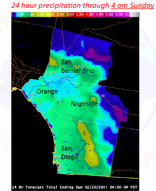
Posted February 19, 2011, 1:53 PM.And that includes the current weekend storm gusting through Southern California, according to Jim Purpura, meteorologist in charge at the National Weather Service's San Diego office, which covers Southern California's inland valleys among other responsibilities. "This system is coming through in several waves", Purpura said. "As a whole, the big difference is that this is not the record (epic) event the December storm was. The initial waves of the storm have more abundant moisture and moderate lifting of the cold airmass. The later waves have very cold air in the the upper levels, meaning more showery (intermittent) precipitation." The first wave of the current storm was through as of Saturday morning, and was the wettest. The second wave was due Saturday night. "Snow levels will be lowest on Friday/Saturday, and may drop down to 3000 feet, meaning the San Jacintos (even the tops of the Santa Anas) may 'light up' with snow cover." Rainfall is above normal, in many cases more than entire season's worth, despite persistent La Nina conditions in the equatorial pacific. Most of the precipitation was due to December's seven day storm. "This is all superimposed on a La Nina Winter," Purpura said. "You'll notice that we have been above normal in rainfall this year, but we've also had long periods of dry weather. This is typical of La Nina. The few wet events weigh heavily in determining whether or not we end up above normal at the end of the rainfall year (June 30)." 
Predicted Precipitation for Saturday's Second Wave (courtesy National Weather Service) 
This Storm's Personality (courtesy National Weather Service) |
Other Recent Weather News for San Bernardino, California
|