Currently
N/A°F
in De Luz, California, USA

N/A°F / N/A°F
N/A
N/A
Friday, April 26, 2024 12:55 AM PDT
De Luz
Currently
Forecast
Past Weather
Climate
Last 36 Hours
Weather News
Features
F.A.Q.
Contact Us
Use °C/Metric
 RSS Feed
 Follow UsWeatherCurrents
Local Roundup
Mobile Access
On Your Site
Follow UsWeatherCurrents
Local Roundup
Mobile Access
On Your Site
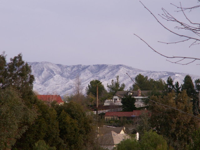
Low Mountain Snow: February 14, 2008
| February 14, 2008 4:30pm: Another view of snow on Agua Tibia mountain, south of Temecula. Agua Tibia is at the western end of the Palomar Range, and is 5077 feet above sea level at its highest point. This photo is from the Meadowview area in northern Temecula. Photo by Spenser Epperson. |
 |