Currently
52°F
in Murrieta, California, USA
52°F / 51°F
3 mph S
0.00"
Saturday, April 20, 2024 2:10 AM PDT
Murrieta
Currently
Forecast
Past Weather
Climate
Last 36 Hours
Weather News
Features
F.A.Q.
Contact Us
Use °C/Metric
 RSS Feed
 Follow UsWeatherCurrents
Local Roundup
Mobile Access
On Your Site
Follow UsWeatherCurrents
Local Roundup
Mobile Access
On Your Site
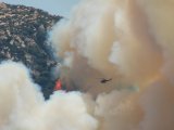
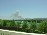
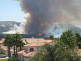
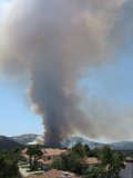
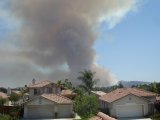
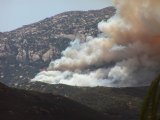
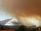
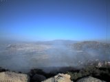
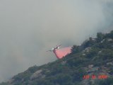
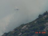
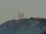
Wildfire Friday Afternoon Closes I15 Freeway at Border Patrol Checkpoint (updated, photos)
Posted June 30, 2006, 5:55 PM.Southbound and most northbound lanes of the I15 freeway remained closed Friday evening as a partially contained wildfire burned 180 acres in the Rainbow gap area, south of Temecula and northeast of Fallbrook, near the San Diego/Riverside county line. The fire reportedly began around 1:30pm. Traffic was snarled in many areas of the city of Temecula, complicated by extra holiday traffic. As of 5pm the fire was 25% contained with 289 firefighters on the scene. Fire helicopters and tankers were also helping to contain the blaze. Two firefighters suffered heat-related injuries. Two northbound lanes through the Rainbow area were open, then three later in the evening. All southbound lanes into San Diego were closed until two reopened around 6pm. The backup northbound coming into the Temecula Valley was to the West Lilac Road bridge, 12 miles away. Temecula

|
Other Recent Weather News for Murrieta, California
|