73°F / 45°F
calm
0.00"
Funnel cloud tracks west of Perris towards Lake Elsinore Sunday
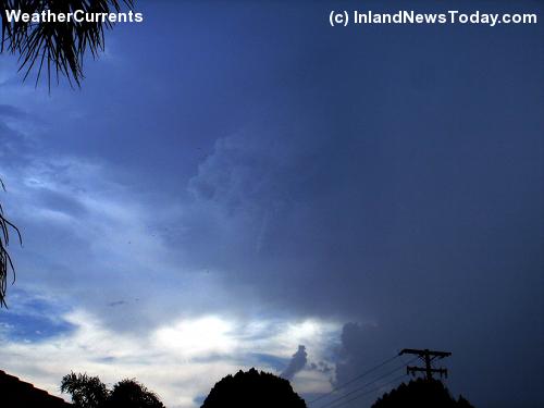
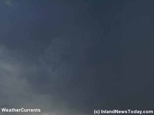
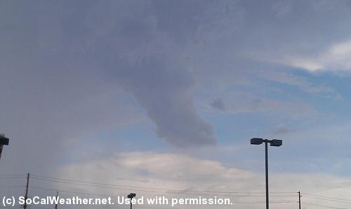
By John C. Toman. Posted August 12, 2012, 10:15 PM.Thunderstorms spawned a funnel cloud which may have made landfall Sunday afternoon. A funnel cloud, the predecessor of a tornado, appeared west of Perris, near the Good Hope area, and made its way ominously towards Lake Elsinore. It lasted approximately five minutes. By 4:25pm, Michael Mojarro of socalweather.net had called in the funnel cloud, and the National Weather Service issued a tornado warning. The funnel cloud was spotted near I15 and State Route 74. According to Inland News Today, "Electricity is being restored to the Lakeview-Nuevo area east of Perris. Straight line winds toppled more than a dozen utility poles and snapped power lines Sunday afternoon." The winds were part of a microburst that preceded the funnel cloud, according to the National Weather Service. A probable tornado was also reported there. Other than the power lines, no other damage was reported. No WeatherCurrents stations reported measurable rainfall on Sunday, despite all of the activity. Forecast were calling again for more thunderstorms on Monday, but with less ferocity. The thunderstorms were also expected to stay further east. All photos below used with permission. 
Funnel cloud west of Perris. © Inland News Today. 
Another view of the funnel cloud system west of Perris. © Inland News Today. 
Approaching Lake Elsinore, near I15 and State Route 74. © SoCalWeather.net. |
Other Recent Weather News for Hemet, California
|