By John C. Toman. Posted December 31, 2011, 1:40 PM.
In what turned out to be a very interesting weather year in Southern California's inland valleys, we were cooler than normal for the second year in a row, La Nina made two appearances, there were wet months, dry months, a spectacular power outage, a wind storm, and the list goes on.
Without further adieu, here's the top inland valley weather stories from 2011:
- November and October rain douses the fire season. With lots of vegetation build-up from the past couple of years rains, there were early hints that 2011 might include a challenging fire season. But it was not to be. Instead, a series of storms from October 4th through November 21st ended the wildfire threat. They also kept most of the Santa Winds away during what is typically their most damaging period. November was especially wet (2.30" in Hemet, 2.18" in Fallbrook, 2.10" in Temecula, 2.09" in Murrieta and San Bernardino, 1.95" in Lake Elsinore, 1.64" in Riverside, 1.62" in Wildomar, 1.40" in Menifee). When the winds did finally blow, later in November and December, the area was still moist, and there were no significant fires.
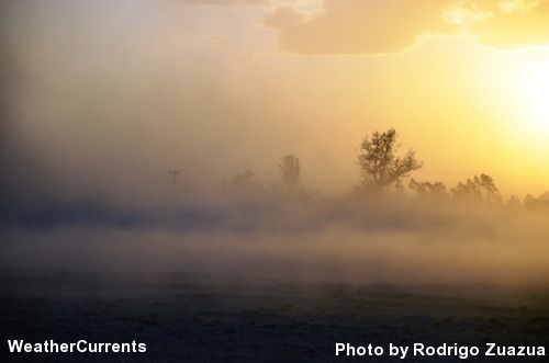
- San Jacinto Valley wind storm, December 16th. We only get a few inside slider storms each year, and they produce some of the wildest weather. They are also some of the most difficult to predict. This year was no exception, with one storm leading to massive winds and power outages up north. This one, on December 16th, struck the San Jacinto Valley hard on a Friday afternoon. Winds were likely 50-60 mph (they topped out at 37 mph at WeatherCurrents' station in Valle Vista, in a wind-sheltered area). The results were blowing dust, downed trees, and localized power outages.
- Damaging winds strike from Cajon pass into Los Angeles. From the tip of our coverage area (North San Bernardino) to the other tip (Simi Valley), brutal Santa Ana winds on December 1st caused widespread power outages, downed trees, and damaged property, from West Los Angeles through the San Gabriel Valley to the San Bernardino Valley. Simi Valley, where WeatherCurrents activated a station in 2011, was spared from the worst of it, as was San Bernardino, also installed this past year. The winds were the strongest in recent years, hitting 97 mph in the Santa Gabriel and Santa Susana mountain ranges. In the WeatherCurrents network, the peak was 41 mph in Riverside. Forecast models showed the strong winds several days in advance, the product of an inside slider, and the forecast impact area included Simi Valley, hence our news story for there. But as is typical of Santa Ana wind events, the actual area of impact was quite different.
- 2011: cooler than normal, again. In our little corner of the world, the last two years have been cooler than average. It's worth noting that this was not true elsewhere, especially over the midwestern United States, which sweltered this past summer. Fallbrook (-1.6°F), Lake Elsinore (-1.5°F), Murrieta (-1.4°F), Temecula (-1.2°F), Hemet (-1.1°F), Riverside (-0.8°F), De Luz (-0.8°F) and Menifee (-0.3°F) were all below normal.
- Late August heat wave - August 25th-28th. This heat wave was a muggy one, and featured the hottest temperatures of the year. Temecula (103.4°F), Murrieta (105.9°F), Lake Elsinore (112.0°F), Hemet (105.1°F), Wildomar (110.8°F), Menifee (109.4°F), Riverside (104.9°F), Moreno Valley (107.6°F), Perris (107.7°F), San Bernardino (106.9°F), Jurupa Valley (105.2°F), French Valley (105.4°F) and Simi Valley (103°F) all had their maximum temperature for 2011 during this period.
- Early September heat wave - September 6th-8th. This follow-up heat wave, after the late August one, wasn't as hot, but made it seem as if the summer heat wasn't going to end. One consequence of this heat wave was a massive power outage that struck San Diego and Imperial counties, as well as parts of Orange County and part of Arizona. Temperatures were generally above triple digits again during this three day period. De Luz (102.3°F) had its hottest day of the year on September 7th.
- Two-faced La Nina strikes twice. A moderate La Nina was present in the equatorial Pacific for Fall of 2010 and Winter of 2011. It's returned for Fall of 2011 and Winter of 2012, following a Spring and Summer vacation. La Ninas are strongly correlated with lower than normal rainfall totals, but that didn't happen for this past rain season, which was the wettest since 2004-2005, and the wettest La Nina season on record. And, despite the resurgence of La Nina, we had a wet November. Since then, though, it's looked more like a typical La Nina season, with a dry December sending rainfall totals inland back below their season-to-date normals. We'll see what the new year brings, but projections from the Climate Prediction Center are predicting a drier than normal, cooler than normal winter.
Dust storm at Ramona Expressway and Vernon Ave., San Jacinto, December 16th (© Rodrigo Zuazua, used with permission)
|
Other Recent Weather News for Temecula, California
-
Storm Totals: April 4th-5th, 2024
April 6, 7:34 PM
-
Storm Totals: March 30th-31st, 2024
April 2, 3:20 AM
-
Flood Advisory issued Sunday morning
March 31, 9:45 AM
-
Flood Watch issued as potentially significant storm approaches
March 29, 4:05 PM
-
Storm Totals: March 23rd-24th, 2024
March 25, 3:48 PM
-
Storm Totals: March 14th-19th, 2024
March 20, 1:48 AM
-
Isolated thunderstorms possible Friday afternoon
March 15, 3:56 PM
-
Storm Totals: March 6th-8th, 2024
March 8, 3:32 PM
-
Thunderstorms possible Thursday evening
March 7, 6:21 PM
-
Storm Totals: March 1st-4th, 2024
March 4, 7:39 PM
-
February 2024 rain totals soar amid very wet month
March 1, 4:05 PM
-
Light rain and unsettled weather for the last week of February
March 1, 3:07 PM
|
 RSS Feed
 Follow UsWeatherCurrents
Local Roundup
Mobile Access
On Your Site
Follow UsWeatherCurrents
Local Roundup
Mobile Access
On Your Site